
Hikes And Nature Trails In Haa Valley
Tucked in western Bhutan, just 70 kilometres (44miles) from Paro and roughly 2.5 hours by road, Haa Valley is one of the kingdom’s best-kept secrets. Closed to foreign visitors until 2002, the valley has held on to a rare sense of stillness that is increasingly hard to find. Today, only a small number of travellers make their way here each year, and that quiet is very much part of its appeal.
Protected in part by the Jigme Khesar Strict Nature Reserve, Haa’s landscapes are rich and beautifully preserved. Ancient pine and rhododendron forests spread across the hillsides, sheltering red pandas, Himalayan monals and over 19 species of rhododendron. Traditional villages, centuries-old monasteries and sacred sites are woven throughout these natural surroundings, making every walk through the valley as much a cultural experience as a physical one.
The hikes and nature trails in Haa Valley are the heart of any visit here. The trails wind through deep forests, cross open meadows and ridgelines, and pass quietly through temple grounds along the way. The pace is unhurried. The scenery is extraordinary. Recently featured by BBC Travel as one of the world’s remarkable destinations, Haa is finally beginning to receive the recognition it deserves.
If you are looking for trails that offer genuine wilderness, living culture and true tranquillity, Haa Valley is waiting.
Hikes And Nature Trails
Meri Puensum Nature Trail
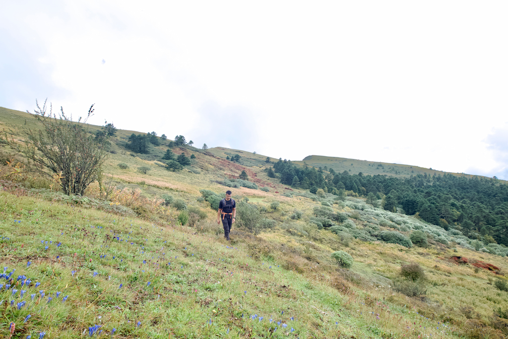
Inaugurated to commemorate the 60th Birth Anniversary of His Majesty the 4th Druk Gyalpo, Jigme Singye Wangchuk, the Meri Puensum Nature Trail is one of Haa Valley’s most rewarding full-day hikes. The trail winds through the Meri Puensum Heritage Forest, a protected area of 563 hectares established in 2016, before delivering sweeping Himalayan panoramas at the summit.
The hike begins at Dumcho, just a 10-minute drive from Haa Town. Before setting off, take a moment to light incense at Lhakang Karpo, a meaningful tradition that sets the tone for the journey ahead.
The ascent takes approximately 4-5 hours through dense forest trails alive with wildflowers that change with the seasons, from bright yellow blooms to delicate alpine flowers depending on when you visit. Along the way, keep count as you cross 13 wooden bridges over mountain streams, each one a small adventure of its own. You’ll also pass through the spiritual landmark of Talela, marked by a traditional stone cairn.
Three canopy rest stops punctuate the climb. The first canopy sits at 3,770 m (12,368 ft), offering your first taste of the breathtaking views above the treeline, with Tagchok Goenpa and Chelela Pass forming a dramatic backdrop. The second canopy serves as the designated lunch spot, a well-earned break with mountain scenery all around. Further along the descent, a third and final canopy offers one last resting point, a welcome shelter nestled among lush greenery before the trail winds its way down to Haa Town.
At the grand viewpoint near 3,800 m (12,467 ft), the reward is clear: magnificent views of Mount Jomolhari and Chelela Pass stretching across the horizon. Standing here, the best thing to do would be Explore - Stop - Breathe.
The trail then descends to Haa Town, ending at the iconic suspension bridge draped in prayer flags. This is a perfect finish to an unforgettable day in the mountains.
Juneydrak Hermitage
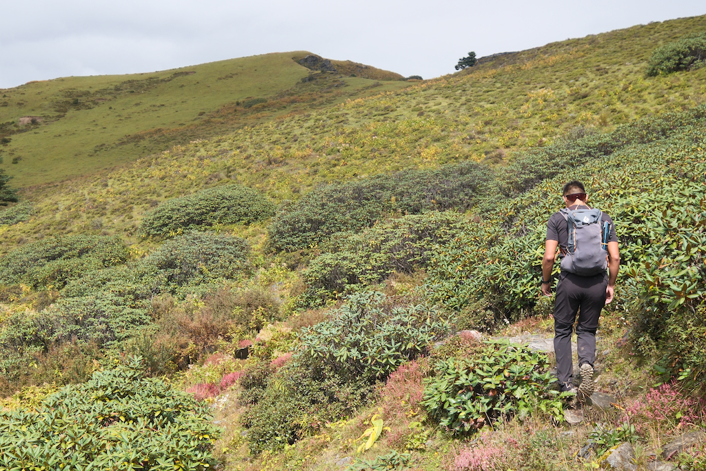
Located just 1 km north of Haa Valley, near Katsho Village, the Juneydrak Hermitage Hike is a deeply rewarding half-day excursion. The trail passes the Chorten Dangrim mani prayer wall, crosses a gentle stream, and winds through peaceful rhododendron and pine forests before a final steep ascent to the cliff-perched hermitage at 2,930 m (9,612 ft).
The entrance itself is unforgettable - a narrow natural stone entryway, guarded by a striking rock painting of a green-faced demon, leads to steep steps ascending into the sacred space.
The hermitage holds profound spiritual significance, housing a rock impression believed to be the footprint of Machig Labdron, the revered 11th-century Tibetan yogini, and is also associated with Guru Rinpoche. From here, spectacular panoramic views of the Haa Valley unfold below.
Nearby, the trail curves around an exposed bluff toward Katsho Goemba, home to exquisite antique thangkas.
Haa Panorama Trail
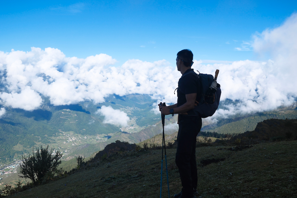
The Haa Panorama Trail is one of the valley’s most complete hiking experiences, weaving together ancient forests, sacred monasteries, sweeping mountain views and an intimate glimpse into rural Bhutanese life across 11 kilometres of well-marked, thoughtfully routed trail.
The journey begins at Yangthang Monastery (2,900 m – 9,514 ft), where a visit to the temple sets a quietly extraordinary tone before the first step is even taken. Inside the grounds grows the Meto Udumvara, a mythical flower with a story rooted in the 15th century. According to local legend, a Tibetan Drupthob carried the last remaining seed of this sacred flower throughout a lifelong pilgrimage, having vowed to plant it at the place where his journey would come to its final end. That place was Yangthang Goenpa. He also left behind a Tashigomang he had carried across the Himalayas before making his return to Tibet. It is a story told by the temple caretaker with quiet reverence, and it stays with you as you begin the walk.
From Yangthang, the trail moves through pine and rhododendron forests, crossing ridges and open meadows with panoramic views of the Haa Valley, nearby villages, and the surrounding Himalayan ranges gradually coming into focus. In spring, the hillsides come alive with the blooms of rhododendrons, painting the forest in shades of pink, red, and white. In autumn, the same landscape turns golden and still.
After roughly two hours, the trail reaches its highest point near the first canopy at around 3,150 m (10,334 ft), where the views open up dramatically to include the three sacred Meri Puensum peaks. Just beyond, the path arrives at the broad, beautiful Katsho meadow.
The trail then passes through Katsho Goenpa, established around 200 years ago by Lam Choney Dorji, who believed his destiny was bound to this hillside and that a temple here would bring lasting benefit to the community. Before construction began, he dreamed of a sky filled with brilliantly shining stars and named the place Kartsho in its memory. The original two-storied lhakhang was destroyed by fire twice and later rebuilt as a single-storied structure, with a central statue of Guru Rinpoche at its heart. Those who wish to shorten the hike may exit here.
Beyond Katsho, the path climbs along rocky mountain trails decorated with prayer flags and traditional stone pathways before descending steeply through mixed conifer forests past Juneydrak Hermitage (2,930 m – 9,612 ft), dramatically perched on a cliff with remarkable views across the valley. It is here that the trail meets the junction connecting to the ancient Kalila route and the Trans Bhutan Trail. A second exit point is available for those who need it.
After the junction, trekkers cross a traditional cantilever bridge, follow a short stretch of paved road, and rejoin the forest path through pine trees toward Wangtsha Village. A final canopy sits at the ridge above the village, framed by prayer flags, with views stretching across the valley floor below. The descent from here is steep, passing through fields and quiet village paths before the hike concludes in Wangtsha, just 3 km (1,8 miles) from Haa Town.
Red Panda Trail
If you’re looking for a hike that takes you deep into one of Bhutan’s last truly wild places - through ancient forests, hidden mountain passes, and the habitat of one of the world’s most elusive animals, the Red Panda Trail in Haa is exactly that.
The day begins long before the first step on the trail. From Haa town, a one-hour, 22-kilometre (13,6 miles) drive winds its way up to Tergola Pass, one of the highest mountains passes in Bhutan. The road climbs through dense rhododendron and juniper forests, occasionally opening up to reveal sweeping views of the Himalayan range. Often referred to locally as the “hidden treasure door,” Tergola is steeped in spiritual significance and remains largely untouched by mainstream tourism. On the road up, you may pass a lone yak herder, and nothing else.
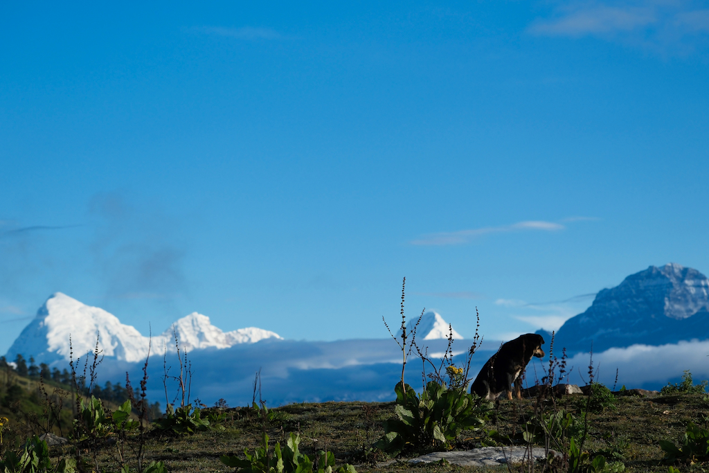
The first stop is the Stupa Viewpoint, perched between 3,720 and 3,770 metres (12,204 ft and 12,368 ft) above sea level. On a clear day, the peaks of Gangkhar Puensum rise sharply on the eastern horizon. On cloudier mornings, the valleys below disappear entirely beneath a rolling sea of clouds. Either way, it’s worth stopping, slowing down, and having a cup of tea. For those who want to go a little further, a short 200-metre climb leads to the summit of the pass at 4,135 metres (13,566 ft), where both Jomolhari and the world’s third-highest peak, Mt. Kanchenjunga, may come into view on a clear day. It’s an optional detour, and one worth considering, though the altitude may not suit every traveller.
From Tergola, a short 20-minute drive brings you to Jilam road point, where the trail begins. The Red Panda Trail lies entirely within the Jigme Khesar Strict Nature Reserve - the only strict nature reserve among Bhutan’s ten protected areas. Unlike national parks, a strict nature reserve carries the highest level of protection, where conservation takes absolute priority. Stretching across the communities of Bji and Sombay in Haa and Tendruk and Norgaygang in Samtse, the reserve sits at over 3,000 metres (9,842 ft) above sea level, where cool temperatures and dense vegetation create the kind of ecosystem that is increasingly difficult to find anywhere in the world. It is here, within these forests, that 42 Red Pandas have been recorded - the largest known population in Bhutan.
The trail unfolds in two sections: the first 1.05 kilometres rolls gently - descending, climbing, crossing a road, descending again- before opening into the longer second stretch, a 3-kilometre path that carries you through dense rhododendron alpine forest and thick groves of bamboo all the way to the endpoint at Legoten road point.
From the moment you enter the trees, the forest changes everything. The canopy closes softly above you. Rhododendron lines the path on either side, not incidentally, but essentially. This is Red Panda habitat: cool, quiet, and dense with the kind of life that doesn’t reveal itself easily. A sighting is never promised, but knowing one might be watching from somewhere in those branches changes the way you walk. More slowly. More carefully. More quietly. In the right season, wild Red Poppies push through the undergrowth in brilliant flashes of colour, as if the forest is showing off just a little.
At just two hours, the Red Panda Trail is one of Bhutan’s more accessible wilderness hikes, but accessible does not mean ordinary. Developed through a conservation-led ecotourism initiative by WWF Bhutan and the Jigme Khesar Strict Nature Reserve, the trail is deliberately designed without large-scale infrastructure. The focus remains on guided nature walks, environmental interpretation, and strict visitor guidelines - keeping the forest as undisturbed as possible. To walk here is to walk lightly, and that is entirely the point.
After the hike, the drive back to Haa town passes through Tergola once more. If the clouds have moved on since morning, stop again at the Stupa Viewpoint. The mountains will look different in the afternoon light. They always do.

Trans Bhutan Trail (Haa-Paro)
The Trans Bhutan Trail is a legendary 403 km (250 miles) hiking trail stretching across nine Dzongkhags, tracing ancient routes once walked by merchants, migratory tribes and government officials of Bhutan. The Haa-Paro leg serves as the trail’s very first section, beginning at Katsho Village, Haa’s smallest gewog nestled between 2,850 and 3,100 m (9,350 – 10,170 ft), and culminating in the iconic Paro Valley.
The trail climbs to a maximum altitude of 3,800 m (12,467 ft), covering 17 km (11 miles) over approximately 8 hours. The first 4-5 hours present a moderate challenge with steeper terrain, though most trekkers find themselves pleasantly surprised by their own endurance. As the trail levels out, the landscape opens up to sweeping Himalayan vistas, ancient forests and quiet alpine meadows - a reminder of why this route captivated travellers for centuries. There is a quiet, almost meditative satisfaction in walking in the footsteps of Bhutan’s history, through a valley that remains one of the kingdom’s least-explored.
For those who find themselves captivated by Haa’s wilderness and wish to venture further, the valley has even more to offer. The Nub Tshona Pata Trek takes you on a spectacular 6-day journey through turquoise lakes, lush meadows, and untouched Himalayan landscapes at around 4,000 m (13,123 ft). This might be one of Bhutan’s most remote and rewarding multi-day trails.
Alternatively, the Chelela Pass Trek offers a stunning 3-day traverse across one of Bhutan’s highest motorable passes, with breathtaking views of Mount Jumolhari (7,314 m -23,996 ft) and Mount Jichu Drake (6,989 m – 22,930 ft) accompanying you from Haa all the way to Paro.
Ready to Explore Bhutan?
Let us craft your perfect Bhutanese adventure
Plan Your Journey