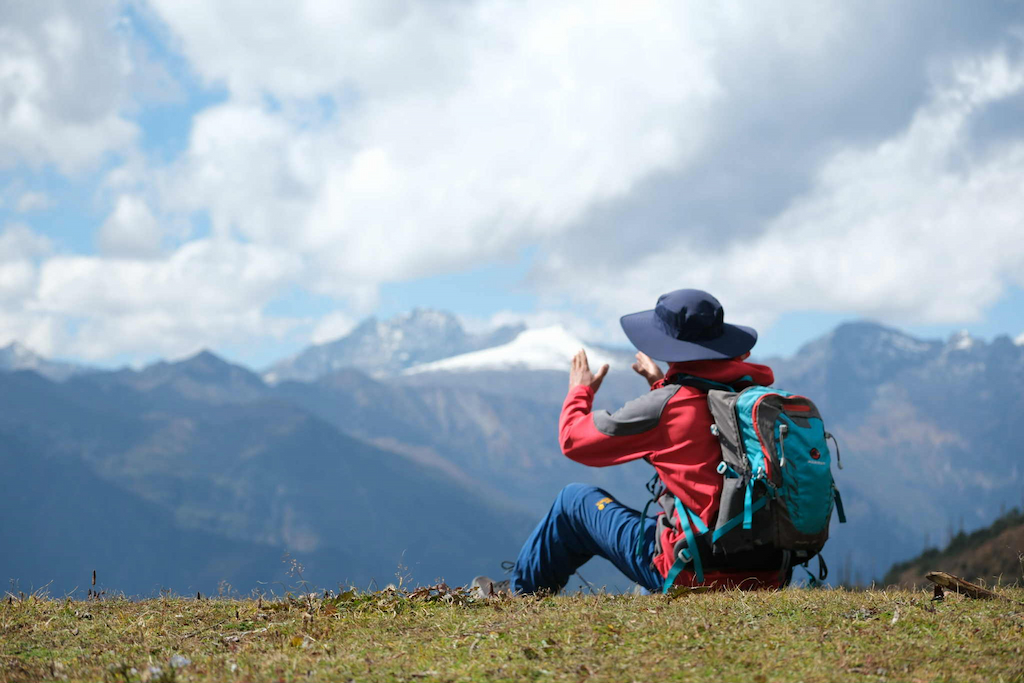
Trekking is the ultimate experience for adventurers in Bhutan to genuinely come in contact with the pristine nature and beautiful culture of this mystic kingdom. The feeling of trekking in Bhutan is unlike anywhere else in the Himalayas.
Bhutan is the first and only carbon-negative country until now. It has 5 national parks, 4 wildlife sanctuaries and 1 strict nature reserve, covering 51.44% of the country. With a forest cover of over 70% and plenty of rain in the monsoon months, Bhutan has an extremely diverse flora and fauna with many rare and endangered animals and plants. You may come across some of them like the blue sheep and takin (Bhutan national animal) when trekking, since most trails will go through forests, national parks, rivers, and also villages.
Treks in Bhutan cater for different levels of fitness: easy to tough, short to long, from lower to higher altitude. For beginners, one of the most popular treks is the Druk Path Trek, from Paro to Thimphu. This trail is fairly easy and will take you to some of the most impressive places in the country. Depending on the trail, the trekking altitudes may range from hundreds to over 5,000m. If you are interested in more strenuous treks, we also provide these hikes at Bhutan Pelyab Tours, such as the “Snowman Trek”. It takes about 30 days to finish the trek and you will be camping at altitudes above 5,000m, and this is one of the most difficult treks in the world.
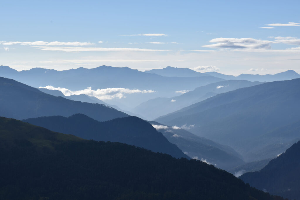
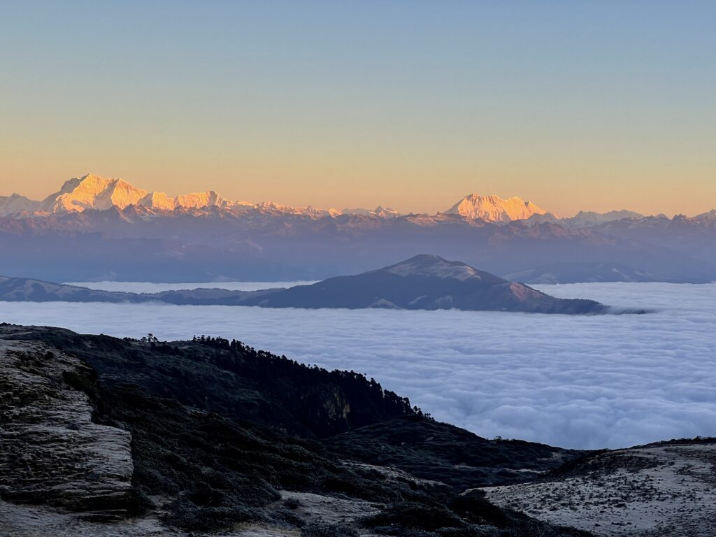
The best time to trek in Bhutan is in spring (March – May) and in autumn (September – November). This is when you will have the greatest view of enormous mountains and scenic valleys. Winter is also a good season for hikes at lower altitudes like the Nabji Korphu trek. Let’s truly immerse yourself in Bhutan’s untouched nature with the breathtaking views of the Himalayan peaks and crystal clear lakes, and sleep under the starry sky!
Tour duration: 15 nights / 16 days.
Trek duration: 11 days.
Tour destination: Western Bhutan.
Packing up and challenging yourself with one of the most strenuous Bhutan treks. The Laya Gasa trail will take you through the most picturesque destinations, with altitude differences between 2,500m to nearly 5,000m. Starting from Paro, you will travel through scenic isolated mountain villages, striking alpine meadows and magnificent waterfalls to finish the trek in Gasa. While on the trek, you will indulge yourself into Bhutan’s pristine nature, and have the spectacular views of the sacred Mount Jhomolhari, Jichu Drake, Gangchhenta (Great Tiger Mountain). Moreover, as you travel to different areas, you will spot some indigenous animals of Bhutan and the Himalayan region. And you will come in contact with the Layaps – semi-nomadic yak herders who live in the northwest of Bhutan. They spend time between their village and the high-altitude yak herding camps and have a very distinctive culture and heritage. As the trek will reach high altitudes, you will have two excursions in Paro in advance to acclimatize.
Late March to June and mid-September to mid-November are the best seasons to take on the Laya Gasa trek to have the finest views of Bhutan’s beautiful landscape and enormous mountains.
Join us for a Laya Gasa Trek 2026:
- Group size: 5- 10 people.
- Dates: 12 October 2026 – 28 October 2026 (16 nights 17 days with Royal Highland Festival).
Join us for a Laya Gasa Trek 2027:
- Group size: 5- 10 people.
- Dates: 19 April 2027 – 04 May 2027 (15 nights 16 days) and 12 October 2027 – 28 October 2027 (16 nights 17 days with Royal Highland Festival).
Day 01: Arrival in Paro
After landing in Paro with a wonderful view of the snowcapped mountain peaks from the airplane, we will have a short break before visiting the National Museum of Bhutan, your first stop to discover. Built in 1649, this construction was then turned into the national museum with valuable collections of the country’s thangkas, festival masks and also a Heritage Gallery, giving you an insight into the unique Bhutanese culture and heritage.
From there, we will visit Paro Rinpung Dzong (Fortress of The Heap of Jewels). Known for its huge buttressed walls, this sight is one of the fine examples of Bhutanese architecture. It was once used to protect the land of Paro, and now houses monk bodies and administrative offices of Paro.
The late afternoon is time for an explorative walk around Paro’s main streets and market to experience the daily life of the locals. We will stay overnight at a hotel in Paro.
Day 02: Discover Paro
In the morning, we will hike to Taktsang Monastery (3,120m). This is one of the most holy landmarks in Bhutan, and it also has another name ‘Tiger’s Nest monastery’. The name Tiger’s Nest originates from the tale that Guru Rinpoche (who had introduced Buddhism to Bhutan), arrived on a tigress and meditated for three months here. To reach the monastery, we will hike a 4.5km trek, which will take around 5-6 hours. There are multiple stops on the way so that you can enjoy the charming scenes of ancient forests and tremendous mountain ranges from afar.
Later, we will head to Kyichu Lhakhang, one of the 108 temples built in the Himalayas by the Tibetan King Songtsen Gampo in the 7th century. It is one of Bhutan’s oldest and most astonishing temples. If we arrive in the late afternoon, you will see the enchanted scene of elderly pilgrims spinning the temples’ prayer wheels.
And we will stay at a hotel in Paro for another night.
Day 03: Shana Zampa – Soi Thangthangkha
- Distance: 20km
- Estimated time: 6-7hrs
- Camp altitude: 3,600m
- Ascent: 770m, descent: 10m
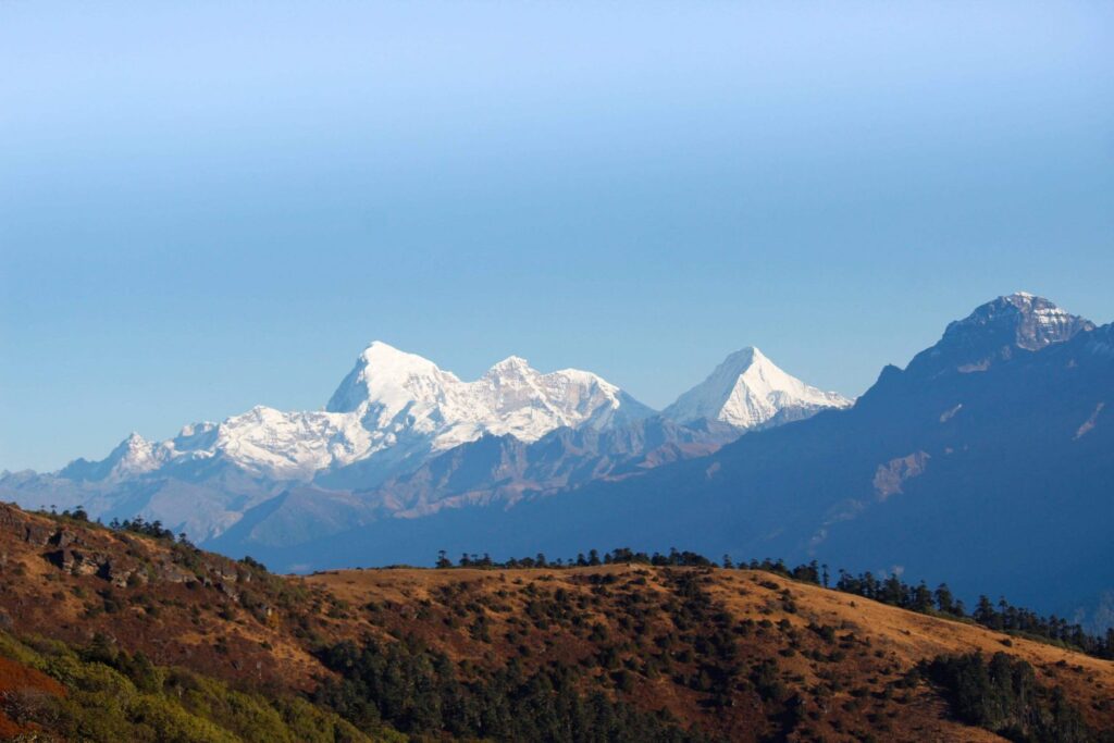
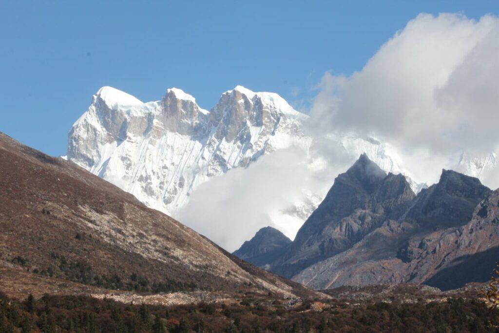
The journey for today will be longer with lots of small ups and downs. After crossing the river valley, we will trek down to a meadow where you will set up your camp, at an altitude of 3,610m. From your location, if the weather is nice, you will have a clear view of the mighty Mt. Jomolhari (7,314m). Its name means ‘Goddess of The Holy Mountain’, or ‘Goddess of The Mountain Pass’ and is a very sacred mountain for the Bhutanese.
Day 04: Soi Thangthangkha – Jangothang
- Distance: 19km
- Estimated time: 5- 6hrs
- Camp altitude: 4,100m
- Ascent: 550m
Getting up and ready for the day, you can spend some time enjoying the view of Mount Jomolhari. Then we will head the road through the dense forest for about 1 hour. Similar to yesterday, we will continue to follow the river and cross an army checkpoint at an altitude of 3,730m. In this area, you will catch the sight of yaks and their herder’s homes quite often. We will also pass some of the villages on the way as we travel further. To finally reach Jangothang campsite, we will continue to hike up. Jangothang is one of the most scenic campsites in Bhutan. As you look out from the campsite, you can again have a great view of Mount Jomolhari but from a new angle.
Day 05: Rest day at Jangothang
Before taking on the next trek, we will have today to rejuvenate and it is possible to do a few easy day hikes to catch the stunning view of fresh-water lakes and snow-capped mountains like the great Jomolhari and Jitchu Drake. Jangothang provides a good environment for you to acclimatize to the more challenging treks ahead. There are some nice trails you can take to discover more of the area like to Jomolhari and its subsidiary mountain chains to the west, Jitchu Drake to the north and even a number of unclimbed peaks to the east.
Day 06: Jangothang – Lingshi
- Distance: 17km
- Estimated time: 6-7hrs
- Camp altitude: 4,010m
- Ascent: 800m, descent: 870m
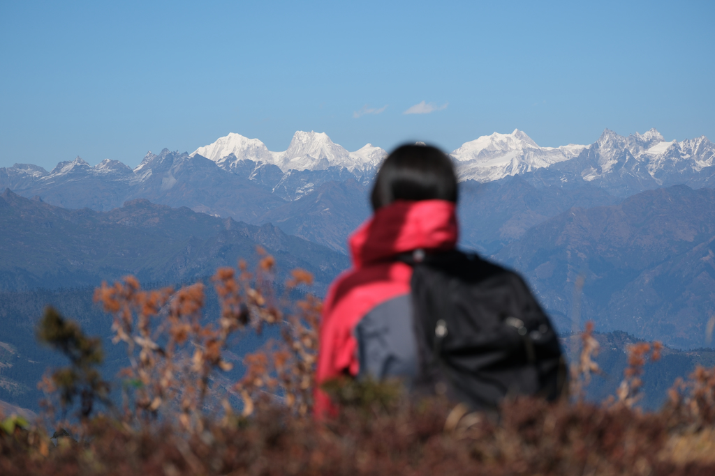
Today’s trek is one of the longest during our whole journey. From your campsite, the track will first head to the north of Jangothang, following with a steep hike for about half an hour and then a more gradual mounting to reach Nyilila pass at 4,815m. When we get to a higher altitude, you will have a great view of herds of blue sheep grazing on the slopes of the mountains. The view of Mount Jitchu Drake is spectacular from the pass. Also, you can take in the sights of Mount Jomolhari and Mount Tsherimgang, all of which rise above 7,000m.
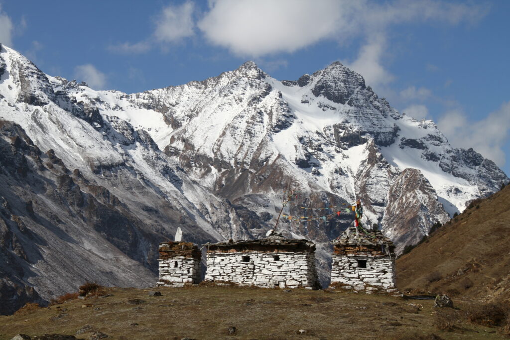
Continuing down the road, you will then descend to the camp and pass some yak herder’s tents. Gradually, we will arrive at Lingshi basin, a charming U-shaped valley. If the weather permits, you will also have the wonderful view of Lingshi Dzong and Tserimgang and its glaciers at the north end of the valley. Your campsite will be next to a stone hut you reach just before Lingshi Dzong.
Day 07: Lingshi – Chebisa
- Distance: 10km
- Estimated time: 5-6hrs
- Camp altitude: 3,880m
- Descent: 200m
Unlike the strenuous journey yesterday, today you will have an enjoyable walk on a wide trail located high above the valley floor. From the campsite, you will soon arrive at a chorten just below Lingshi Dzong (4,220m), where you can pick to continue on the main trail or do a detour up to the dzong. The dzong is located on a high ridge at 4,220m. If you hike up to the dzong, spend some time enjoying the nice view of the picturesque valley. After just 1 hour of a gradual hike, we will see a cairn with some prayer flags on Talela ridge (4,100m), from where you can see Nyilila pass and Mount Jitchu Drake.
Later, the trail will descend towards a side valley, and we will visit Lingshi and Goyul villages. Houses in Goyul are made of stone and clustered together, which is uncommon for Bhutanese houses, making it an interesting sight. Moreover, there is Ja Goed Dzong located in Goyul village, which is worth visiting. It is one of the four temples built by Phajo Drugom Zhigpo, and is one of the most sacred in Bhutan. Getting to the campsite at Chebisa village after another hour of trekking, you can wander around and see the lovely waterfall behind this small village.
Day 08: Chebisa – Shoumuthang
- Distance: 18 km
- Estimated time: 6-7hrs
- Camp altitude: 4,200m
- Ascent: 600m, descent: 350m
The trail from Chebisa village will start with a long ascent through a wide grassland, leading to Gogu La pass (4,460m). During the hike, you will spot large herds of blue sheep or herders with their yaks. Crossing Gobu La pass, the trek will descend gradually to Shakshepasa (3,980m), a large beautiful U-shaped valley. Walking from here, we will finally reach the campsite at Shomuthang, located above the river, which is a tributary of Nochu river.
Day 09: Shoumuthang – Robluthang
- Distance: 18km
- Estimated travel time: 6-7hrs
- Camp altitude: 4,160m
- Ascent: 500m, descent: 600m
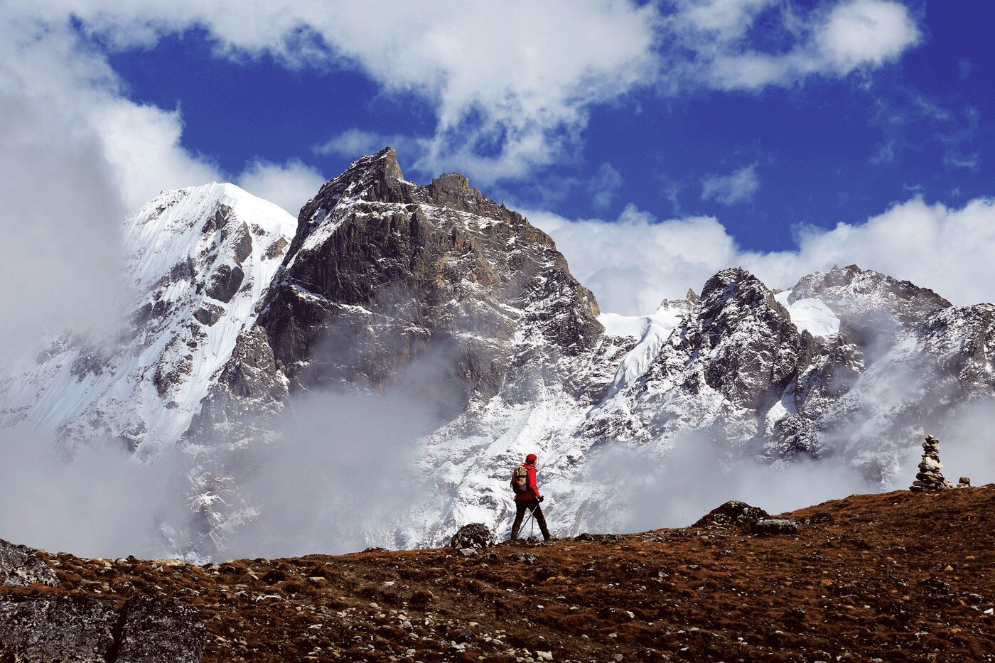
We will first hike up the valley to observe Kang Bum Mount (6,526m) and lovely edelweiss (a flower which is only found in remote mountain areas). Another 2 hours of hiking and we will reach Jhari La pass (4,730m). As you look out from here, you can enjoy the view of Sinche La pass, where we will hike to the next day. To the north is a stunning snowy peak, which is a part of Gangchheta Mount (Great Tiger Mountain). If the sky is clear, Tserim Kang Mount and the top of Jomolhari Mount will be visible. The campsite by the river Tsheri Jathang, is located in a wide and alluring valley. In the summer, herds of Takin – Bhutan’s National Animal will migrate to this valley and stay for about 4 months. Thus, the valley is now a takin sanctuary. We will hike up a bit to get to the campsite at Robluthang.
Day 10: Robluthang – Limithang
- Distance: 18km
- Estimated time: 6-7hrs
- Camp altitude: 4,140m
- Ascent: 850m, descent: 880m
Today’s trek will be more challenging. At the start of the hike, we will cross some small streams and gradually hike up through a boulder field for about 1.5 hours. From then, we will take on a steep ascent for another hour to reach Sinche La pass (5,005m). This is the highest pass on this trek unless you will continue the Snowman trek from Lava onwards. At the foot of the valley, you can catch the sight of an impressive terminal moraine and a charming glacier lake to the far side of Sinche La pass. To the northeast of this pass, you will see the glorious Mount Gangchhenta. This massive mountain is covered in snow and ice, rising to a remarkable height of 6,840m.
Next, we will cross Kango Chhu to soon arrive at Limithang campsite (4,140m), right after we pass through a lush cedar forest. Even from your campsite, you can still see the peak of Gangchhenta towers from far away.
Day 11: Limithang – Laya
- Distance: 10km
- Estimated time: 5hrs
- Ascent: 60m, descent: 300m
- Camp altitude: 3,840m
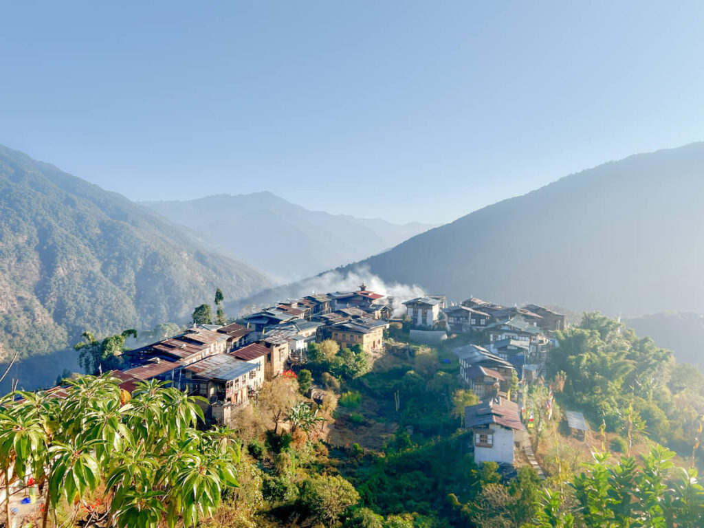
Today, we will have only a small ascent and the rest of the trek is downhill. We will follow the trail along a narrow, winding river valley before crossing a dense forest. The trek will take us to the west side of Laya village, where we can have the chance to explore the next day. From here, Mount Gangchhenta and Mount Masagang can be seen, and the view is wonderful. You will find in the village center a basic health unit and a community school. The campsite is just below the community school.
Day 12: Rest day at Laya village
Today we will slow down with some rest, exploring Laya village and meeting the local people. This is your chance to genuinely learn about life of the Bhutanese in this region.
Probably the first thing to notice is the distinctive dress of the Layap women, which is made of yak hair and sheep’s wool. The attire includes a black skirt with brown vertical stripes, a black jacket (khenja) and on top of their head the women wear a unique conical bamboo hat with decoration hanging at the back. In Laya, women tend to look after the yaks, and weave, and they also weed, harvest and thresh! Layap men are often on trading missions and responsible for ploughing the fields with the yaks. You may also see people practicing archery with traditional bows – Bhutan’s National Sport.
While you are here, you can try out the hot stone bath. The wooden boxes are partly buried in the ground, then filled with water, sometimes herbs are added in for health purposes. Next, they will warm up the water by heating the stones and then drop them into the bath. The hot stone bath is a very pleasant experience for visitors to the village.
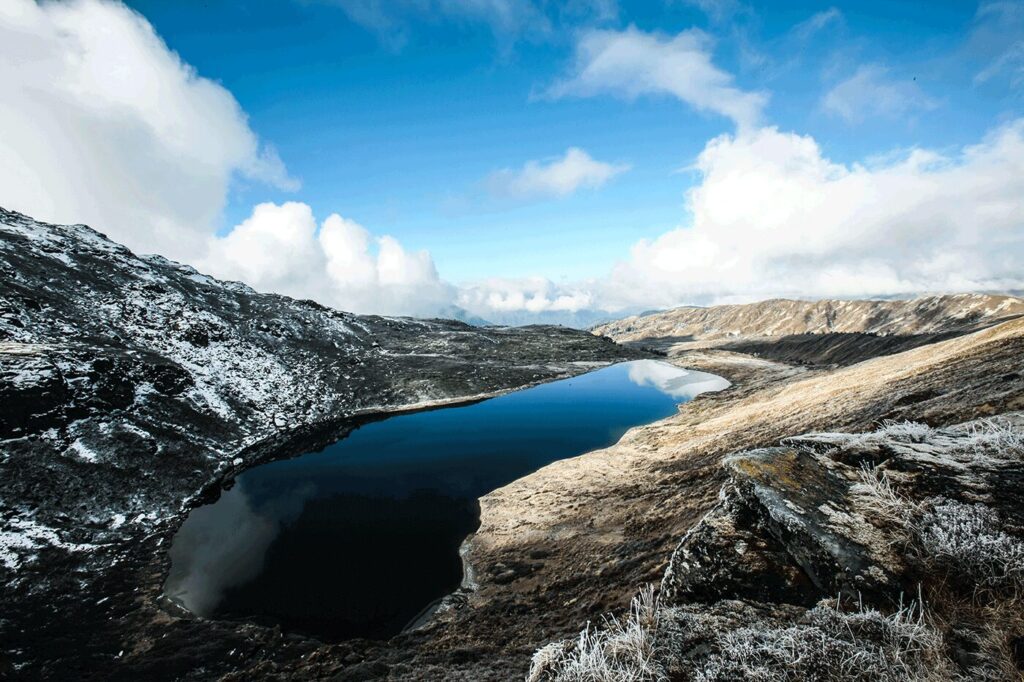
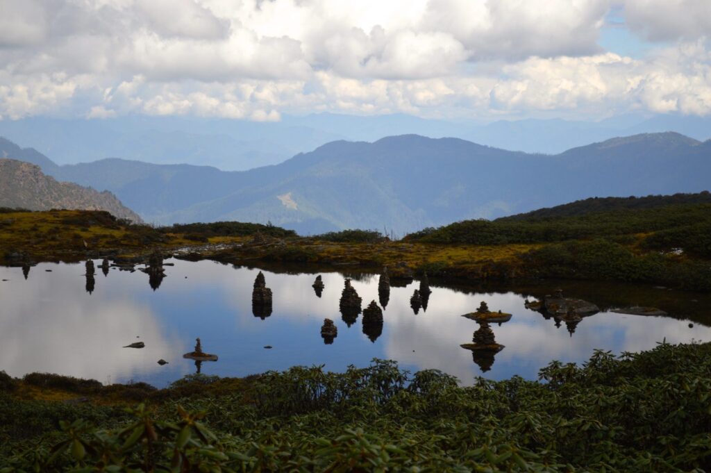
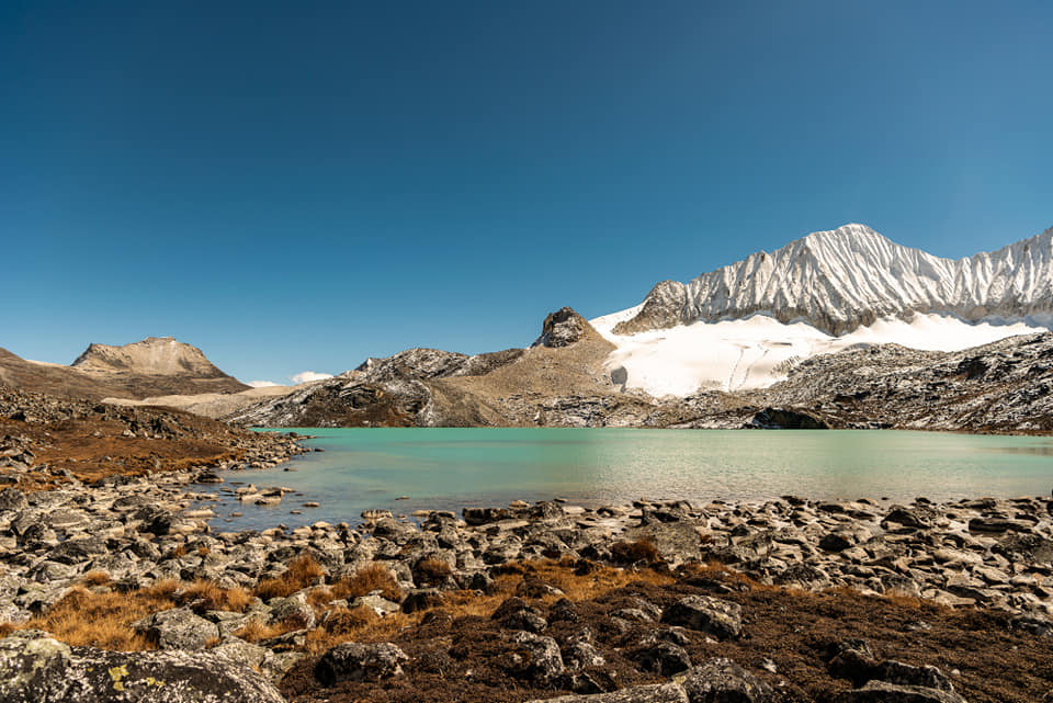
The village is close to a number of holy lakes, which are Kharkhil Tscho, Paro Tsho and Oneme Tsho, in the area of Chhuton Chhagari. Simply enjoy the view of these crystal clear lakes and indulge yourself in the pristine nature of the area. The lakes, surrounded with green meadows, is always a nice change of scenery from the colossal mountain ranges on your trek. Otherwise, visiting the hot springs at Lungo village can also be an option for you.
Day 13: Laya – Taktsemakha – Punakha
- Distance: 4,5km
- Estimated time: 2 -3hrs
- Ascent: 260m, descent: 1,070m
From today, we will descend gradually as we travel. The trek will switch between ups and downs continuously before taking on a steep descent throughout the day. We will start with small ups and downs to avoid natural obstacles, along the Mo Chhu river valley. You will have a nice view of the raging river, feeder streams and stupendous waterfalls. Then we will get to Kohi Lapcha pass at an altitude of 3,300m. Afterwards, we will walk down to Taktsemakha and your car will be waiting at the trek’s endpoint to take you to Gasa Dzong. It will take about 2-hour drive from Taktsemakha to the Dzong (36 km)
On the way, we will visit Gasa Dzong. It was built in 1646 by Zhabdrung. The locals call it the Tashi Thongmon Dzong, named after the region’s protecting deity Tashi Thongmon. The dzong has a distinctive structure with a circular shape and three watchtowers standing at strategic points. During clear days, the sight of Gasa Dzong becomes extremely breathtaking with the backdrop of the mighty Mount Gangboom.
Afterwards, we continue to drive to Punakha, it will take about 3-hour drive from Gasa Dzong to Punakha (75 km) and you will stay overnight at the hotel in Punakha.
Day 14: Punakha sightseeing
We will spend the day discovering the charming landmarks in Punakha valley, with the first stop being the Sangchhen Dorji Lhuendrup Lhakhang. This beautiful two-story temple is also a nunnery, from here you can overlook the astounding landscape of Toebesa, Punakha and Wangduephodrang valleys. The temple houses a permanent higher learning and meditation centre for nuns, providing religious training as well as other life skills like tailoring and thangka painting.
Then we will visit Punakha Dzong (Palace of Great Happiness) and Pho Chhu Suspension Bridge. The Punakha Dzong is praised as the most striking dzong in Bhutan with its splendid structure. It is a symbol for a unified Bhutan, standing at the confluence of Pho Chhu and Mo Chhu rivers. Just passing the dzong and we will see the famous Pho Chhu Suspension Bridge – one of the longest of its kind in Bhutan at the length of 160m.
Our last destination for the day is Khamsum Yuelley Namgyal Chorten. We will take an easy trek to get to the chorten, crossing lovely rice fields and pine trees. The chorten’s architecture is one of a kind, turning it into a great architectural icon in Bhutan. Her Majesty the Queen Mother erected this remarkable building to be delicate for the wellbeing of the whole kingdom. From the chorten, you will be rewarded with the best view of the whole Punakha valley.
From the site, it will take approximately 30 minutes to hike down. We will spend our night at a hotel in Punakha.
Day 15: Punakha to Paro
- Distance: 125km
- Estimated travel time: 4hrs
We will travel back to Paro, which is about 125km away from Punakha. We will follow an easy trail across lovely hillock fields to Chimi Lhakhang (Temple of Fertility). The yellow-roofed temple was built in the 15th century by Lama Drukpa Kuenley –“Divine Madman”. Childless women go to the temple to pray and receive a wang (blessing or empowerment), while mothers-to-be select their future baby’s name from a collection of bamboo slips.
On the way, we will also stop at Dochula pass. At 3,050m, this famous pass overlooks the Himalayas with 108 chortens (stupas) known as “Druk Wangyal Chortens” and Druk Wangyal Lhakhang.
Furthermore, we will travel to the National Memorial Chorten. This outstanding building serves as the monument of world peace and prosperity, as well as the memorial to the Third King, His Majesty Jigme Dorji Wangchuck (1928-1972), the one who had erected the chorten.
Buddha Point (Buddha Dordenma Statue) will be the last site to see today. This prominent Buddha statue stands at a height of 51.5m on top of a hill in Kuenselphodrang Nature Park. This is one of the largest statues not only in Bhutan but even in the world. The statues emanate an aura of peace and happiness, which you can feel once you reach the site.
Afterwards, we will return to the town and stay overnight at a hotel in Paro.
Day 16: Depart Paro
We will head to the airport after breakfast for your flight to your next destination, marking the end of your Bhutan journey. Tashi Delek (goodbye and good luck) and hope to see you again!
Inclusions:
A Bhutan visa fee.
3-star and 4-star hotels on our hotel list.
Twin sharing room at hotels.
A car with an experienced driver throughout the trip.
Three meals (breakfast, lunch, and dinner) in a day.
Bottled water is provided on non-trekking days, while boiled water is available for refilling reusable bottles on trekking days.
A sustainable development fee of US$ 100 per person per night.
A 5% Goods and Services Tax (GST) on tour package.
Museum fees, all park entrance fees, and trekking permits.
Sightseeing as per itinerary with a qualified and licensed English-speaking guide on non-trekking days.
An experienced and licensed English speaking trekking guide, cook, helpers, horses, and horseman on trekking days.
Trekking equipment: sleeping tent (full carpet, thin foam mattress with a bedsheet, foam pillow, and one small blanket); shower tent (soap, towel, and warm water); kitchen tent; dining tent; toilet tent (toilet pot and paper); sleeping bag; accommodation in twin sharing tent.
Horses to carry 25 kg personal belongings.
A shared group medical kit.
A group satellite phone (carried by the tour guide).
Gho or Kira (traditional and national dress of Bhutan) for your use during your stay in Bhutan.
Physical Bhutan sim card.
Archery (Archery is the national and most popular sport in Bhutan. There are traditional bows and arrows available in case you want to try this sport. Your guide and driver will be very happy to show you the basics of playing it).
A traditional hot stone bath at a farm house.
Exclusions:
Laundry, beverages, telephone calls, and any personal expenses.
Travel insurance.
Airfares.
Airport taxes if any.
Excess baggage charge.
Tips for a trekking team and driver
Services not mentioned.